General Plan Guidelines Data Mapping Tool
The General Plan Guidelines Online Mapping tool draws data sets from multiple sources, allowing users to incorporate local, regional, and state wide data as available into local general plans without cost. Additional data will be added as it becomes available.
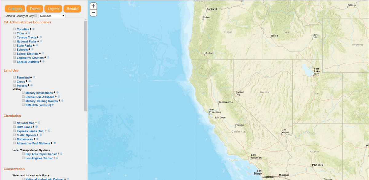
Data is grouped by both general plan category, and by common themes. Data is loaded in the viewer by simply clicking the layer on/off in the corresponding checkbox. Download and metadata are available on supporting layers, and accessed through the buttons next to the layer name. Opacity is controlled through the slider that appears above the layer when loaded.
The toolbar provides basic navigational functionality, in addition to the ability to query data, change basemaps, add and save graphics, measure distances and areas, save session state in a URL, and add outside map services or shapefiles, including files with local data.
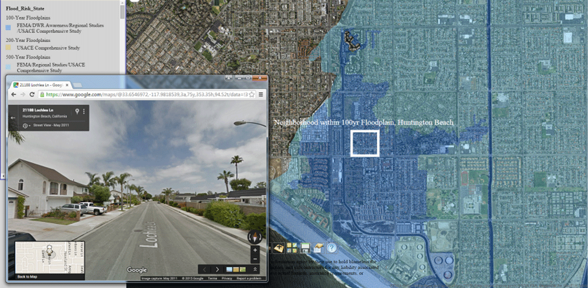
Overhead imagery is available from the selection of basemaps. Additionally, ground-level imagery can be accessed by choosing the streetview icon and clicking on the map (zoomed in to city-scale). Oblique coastal imagery can be accessed by choosing the coastal photos icon and clicking anywhere on the coastline.
Maps produced may be saved locally in either .xps or .pdf formats.
This product is provided for informational purposes only. Upon the sole determination and discretion of the users of this information, work may be used to assess actual hazards, insurance requirements, or property values. Users of this information agree by their use to hold blameless the State of California, and its respective officers, employees, agents, contractors, and subcontractors for any liability associated with its use in any form.
For questions concerning this application, please contact Suzanne Hague regarding data availability and policy or John Carotta regarding tool troubleshooting or technical questions.